 Knowing the location of a wildfire in relation to where you are is critical when deciding whether to evacuate, stay where you are or move to a safer place.
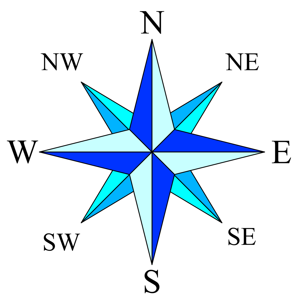
Typical sources of information are TV, radio, the Fires Near Me map at www.rfs.nsw.gov.au, the Fires Near Me App available from your mobile device’s App Store (free), and social media. Regardless where you get your information they all require some understanding of maps and direction.
This task will help you use the information that you get from these sources to make safer decisions. We are going to get comfortable with map reading and the points of a compass in this task.
News Reports and Warnings
News reports about fires will often refer to wind directions and fire locations relative to a town or other landmark using the points of the compass. For example “The fire is 10 Kilometres to the south-west [SW] of Katoomba with a South-Westerly wind behind it“. Did you know this means the fire and embers are being blown towards Katoomba? This task will help you interpret these directions.
In the Blue Mountains fires often occur during hot dry winds that blow from the north-west (NW). The weather people call this a ‘North-Westerly’ because that is where it is blowing from. In eastern Australia ‘Easterly’ winds are usually cooler and wetter because they come from the ocean.
Start thinking about how a fire, 5 KM North West of your location, might affect you. Other tasks later in this series will give you important tools to make the call.
TASK: Where is north from your place?
Everyone knows the Sun rises in the east and sets in the west, depending on the time of year it’s just a little different. But that won’t ruin the experiment or your fun.
Stand with your arms out – right hand pointing to the Sunrise, left hand pointing to the Sunset. Look straight ahead. The direction you are facing is north. You are also performing yoga so you can thank us later for your good health!
Great work! Although, that was a pretty rough estimation of north it will help you get your bearings. Lets find out a bit more…
Find your house on a map
Grab a map and look for your street.
On a paper map north is at the top. (Unless the pirate cartographer had a little too much rum.)
On Google Maps, when the page first loads, north is also at the top. (If you start clicking buttons, it might start turning. If you are not sure, Sydney is on the right hand side of us and Lithgow on the left. Bingo! You are holding the map the right way up!).
Now that you have north at the top of your map, look for landmarks directly above your place on the map and you will have an idea of where north is in relation to your home.
If you like gadgets, this might be a good excuse to go shopping for a compass, you know, just to be sure.
Having fun? Why not repeat your experiment for work, school or a friend’s house in case you are there in an emergency.
Bonus Points
Locate the following landmarks on your map:
- The nearest cross street
- The local shops
- A park or sporting field
- The closest access to the Great Western Highway